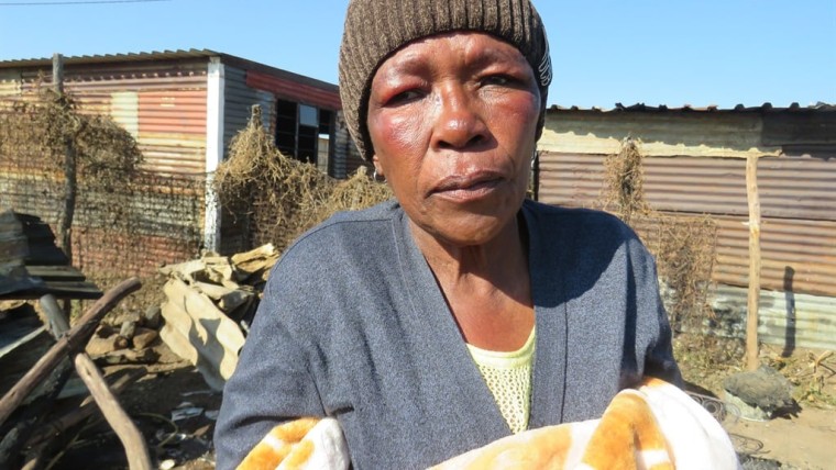
Celebs And Viral Maria Khanye from Snake Park, Nigel, lost her 25-year-old son Japhta and 2-year-old granddaughter Ntando in a shack fire last Sunday Maria Khanye lost a son and a grandchild in a fire at Alra Park in Nigel on Sunday. Photo by…
Celebs And Viral Maria Khanye from Snake Park, Nigel, lost her 25-year-old son Japhta and 2-year-old granddaughter Ntando in a shack fire last Sunday
Gossip South African TikTok creator Sarah Bathi, who reportedly took her own life due to bullying about her weight on social media platforms
Celebs And Viral Maria Khanye from Snake Park, Nigel, lost her 25-year-old son Japhta and 2-year-old granddaughter Ntando in a shack fire last Sunday
Gossip Hungani and Stephanie Ndlovu Divorce After Six-Year Marriage A recent report, has sent shockwaves across social media with a headline that’s almost too painful to read: “Scandal! Stars Hungani and Stephanie Ndlovu Divorce After Six-Year Marriage.”
Gossip “He Didn’t Wanna Go”: Presley Chweneyagae’s Final Farewell Leaves Mzansi in Tears Presley Chweneyagae. But babes, this wasn’t just any funeral. It was a moment. A spiritual shake-up. A goodbye that refused to go quietly.
Skeem Saam From Wedding Bells to Tears for Mapitsi and Lizzy’s after their Marital Struggles marriage isn’t just about the celebration, but the journey that follows. Watching Mapitsi and Lizzy struggle in their marriages is heartbreaking
Latest news Fikile Zwane was killedby her friends Over R1,000 Dispute A Friendship Turned Fatal: The Tragic Death of Fikile Zwane How does a bond built on trust turn into a nightmare? How does a disagreement over R1,000—an amount so small in the grand scheme of life
Gossip Khanyisa Jaceni welcomes her baby boy in a Heartwarming Video South African musician and social media personality Khanyisa Jaceni has welcomed her first child, sharing the joyful news with fans via Instagram on Sunday. The amapiano star posted a tender photo holding her newborn son, marking a new chapter in her life. A Celebrated Journey to Motherhood The birth follows Jaceni’s April 2024 pregnancy announcement
Coming Soon to Netflix, Uncategorized, US Open Here’s What’s Coming to Netflix This Week: June 9th to 15th, 2025 Netflix is rolling out over 20 new additions this week, featuring FUBAR’s second season alongside some must-watch documentaries and movies.
Technology Actress Khanyo Maphumulo reveals she was paid under R10,000 for her role in Sarafina. Veteran South African actress and singer Khanyo Maphumulo has broken her silence about one of the most disheartening moments in…
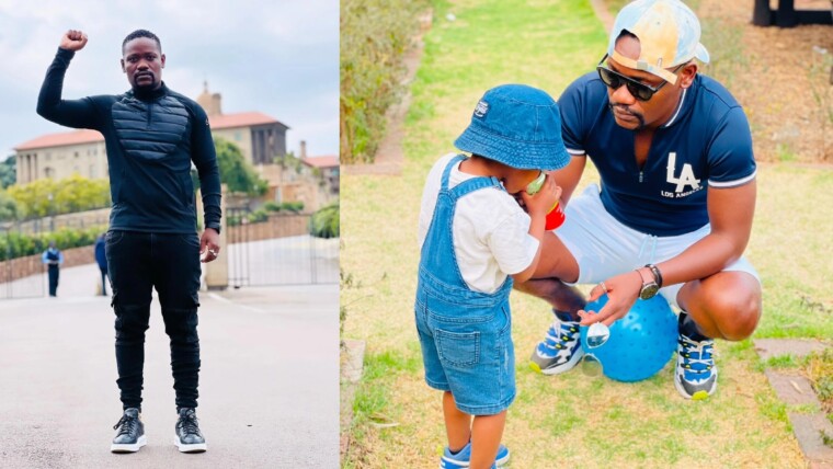
Clement Maosa, Gossip Clement Maosa’s Journey of Healing and Hope on the Loss of His Parents and Life After Tragedy South African actor Clement Maosa, widely recognized for his role in the popular soap opera Skeem Saam, has courageously opened up about the profound loss he experienced in his youth.
Gossip Khosi Twala’s Wedding with Stunning Traditional Lobola Photos Khosi Twala, former Big Brother Titans winner, has sparked wedding rumors with stunning traditional lobola photos on Instagram. The South African reality star posted breathtaking images in traditional Zulu bridal attire, featuring intricate beadwork and luxurious fabrics.
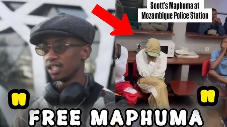
Entertainment, Scotts Maphuma, Uncategorized Scotts Maphuma Arrested in Mozambique: Mzansi Reacts South African Amapiano sensation Scotts Maphuma has reportedly been arrested in Mozambique, where he was scheduled to perform. The incident, which surfaced on Monday, 2 June 2025, sparked widespread discussion online after a popular entertainment blog, Maphepha Ndaba, shared a video of a man dressed like Maphuma being apprehended by local police. Sketchy Details Surround